Drone Roof Inspection in Anchorage, AK
Overview
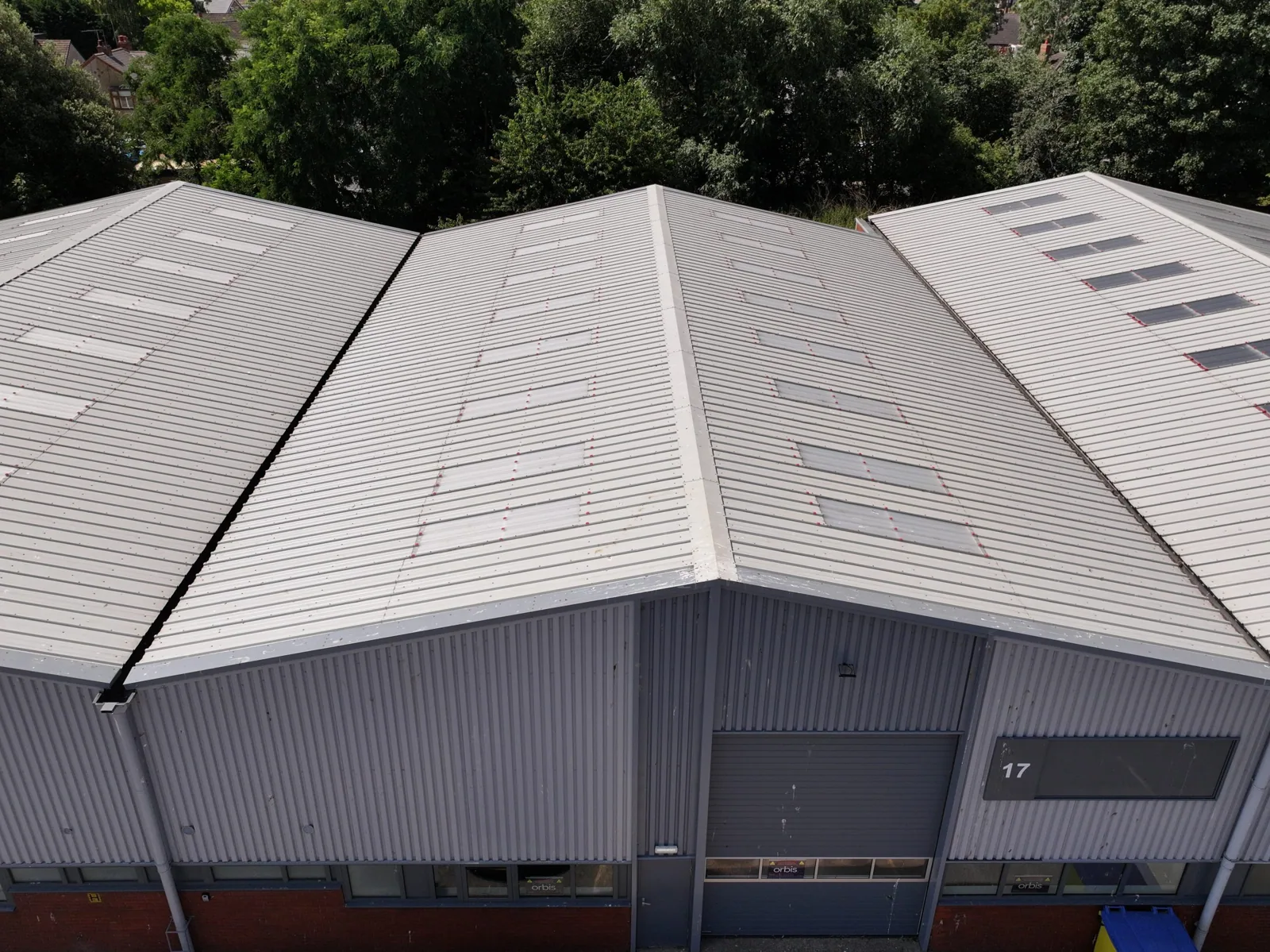
Aerial images are most useful when they answer a defined inspection question. In Anchorage, AK, a roof may be difficult to reach because of snow, height, equipment, or the building’s access rules. Drone imaging can document visible seams, edges, drains, and rooftop features without placing an inspector on every roof area. It does not replace hands-on review where a detail must be touched, tested, or opened.
We begin with the roof plan, reported concern, and flight access conditions. The imagery is labeled by roof zone and tied to the question being investigated. In the International Airport Road corridor, airport-related activity and nearby commercial uses make property-specific access coordination important. We confirm permissions and operating constraints before scheduling a flight.
Related Pages
Which roof questions fit aerial imaging?
Drone photographs can give the facility director a broad view of roof layout, rooftop equipment, drainage paths, snow accumulation, debris, and visible surface conditions. They can help document a large or hard-to-access area, compare zones, or capture a condition before repair. If a roof map is incomplete, imagery can also help orient later hands-on inspection and maintenance records.
Anchorage includes the Ted Stevens Anchorage International Airport complex and commercial corridors that serve freight and logistics activity. Those regional facts explain why some properties have extensive roof footprints or controlled access settings, but they do not establish a particular building’s size or use. We assess each site’s geometry and permissions before choosing whether imagery can answer the owner’s question.
A drone view can show where snow has accumulated or where an outlet may be obstructed. It cannot determine roof load capacity, confirm wet insulation, or establish why water entered the building. When a temperature pattern or leak history points to hidden moisture, infrared and targeted testing can provide a more direct check. We state what the images show and which conclusions need another method.
How is a useful flight scoped?
Before launch, we review the roof boundaries, target details, nearby obstructions, weather, and property access. The facility contact identifies sensitive areas, occupied entrances, active work zones, and operating hours that affect the flight. We select image angles and roof zones that can answer the requested question. A single overhead pass may miss a wall transition or a detail hidden behind mechanical equipment, so the plan includes oblique views where appropriate.
Wind, precipitation, low light, snow, and ice can affect both flight safety and image quality. Anchorage weather requires a date and time that support clear, stable capture. We do not treat a weather-limited image as a full condition survey. If the roof is snow-covered, the images may help record coverage and access conditions, while seams and drain details could remain concealed.
Images are organized by roof zone, with orientation and capture date included in the record. The facility team can compare those views with a roof plan, maintenance notes, or a reported leak. If the property lies near Midtown or Downtown Anchorage, we still confirm the flight boundary with the owner; a neighborhood label does not grant access or permission for a specific property.
What can the images prove?
A clear photograph can show an open seam, displaced flashing, debris at a drain, a visible puncture, surface wear, or snow accumulation at a particular time. A comparison set can help the owner see whether an observable condition changed between visits. We mark the relevant feature and describe the image limits, such as glare, shadow, obstruction, snow cover, or camera angle.
Visual evidence has boundaries. A drone cannot feel a soft insulation area, verify adhesion, measure concealed moisture, or confirm the deck beneath a membrane. If the image suggests a possible concern, a hands-on roof inspection checks accessible details and can identify test locations. When a repair is needed, we use the observed defect and field findings to set the repair limit rather than treating the photograph as the whole diagnosis.
For roof drainage, aerial views can show the route from a high area to a drain or scupper. They do not always show whether an outlet is clear below a grate or whether water is trapped under snow. We combine the view with safe, direct inspection when drain performance or flashing condition must be confirmed. The final record says which points remain unverified.
How do access rules affect capture?
A flight is scheduled with the property owner’s permission and a clear work boundary. Some buildings operate near air traffic, controlled facilities, or other sensitive locations. The owner can identify restrictions, and we verify that a flight can proceed under the applicable site requirements before confirming a date. If a flight is not appropriate, we explain an alternate inspection method instead of forcing imagery into the scope.
The airport reports a 4,612-acre complex with cargo and logistics development areas. That is a fact about the airport, not the size or access status of neighboring properties. For buildings in the airport corridor, the facility contact can clarify site access and any operating conditions that affect inspection. We keep that coordination focused on the specific parcel and avoid assuming permission from proximity.
On an occupied building, we also protect pedestrian paths and coordinate with staff who may be affected by the flight. The person responsible for roof access should know when the imagery is being captured and how the results will be delivered. If a lift, roof walk, or test cut follows the flight, we schedule those activities separately with the appropriate contact.
What should the inspection record include?
The deliverable should include dated images, a roof-zone key, the question being investigated, and notes on visibility limits. Each photograph needs enough context to locate the detail, plus a close view when a feature may require repair. We connect the image set with the roof plan and the facility’s maintenance record so the next inspection can revisit the same zone.
If imagery identifies a concern, the report should say whether it is visible evidence, an interpretation, or a recommendation for hands-on confirmation. A condition report can combine drone images with inspection notes, test locations, and repair priorities. For ongoing roof oversight, an asset record can preserve the history by zone and date.
Share the roof plan, target question, access contact, flight restrictions, and any recent leak or snow history. We will determine whether aerial imaging can answer the question, organize the images by roof area, and identify what needs direct inspection. If the images support repair, our repair scope will identify the material, detail, and work boundary.
Commercial Roofing Questions
When does an aerial view help answer a roof question?
No. Aerial images document visible conditions and can guide where a roof walk or test should focus. They cannot confirm adhesion, concealed moisture, soft insulation, or the condition beneath the membrane. We state which roof zones were imaged and which observations need hands-on review.
Can drone images identify a roof leak?
The images may show a visible opening, separated flashing, debris, or a drainage condition near the reported area. They do not prove the water entry path by themselves. We compare imagery with the leak timeline and inspect the roof detail before defining a permanent repair.
Can you capture a roof covered in snow?
A flight may document snow coverage and broad roof features when weather and access allow. Snow can conceal seams, drains, and surface defects, so those details may require a later visit after safe access is available. We mark the limitation in the image record.
What access details do you need before scheduling?
We need the property contact, roof plan, permitted capture area, site rules, operating hours, and any restrictions near occupied or controlled spaces. The owner confirms permission for the property. We verify whether the planned flight can proceed before setting the inspection time.
How should the images be used after delivery?
Keep the zone key and capture date with the roof plan and maintenance record. The facility team can use them to track visible changes or direct a repair inspection. If a photo raises a question about concealed layers, use a hands-on review or targeted test rather than treating the image as proof.
Set the imaging question first
Send the roof plan, target area, site contact, access rules, and recent leak or snow notes. We will confirm whether aerial capture fits the site and return labeled images with any needed follow-up inspection.
Request a roof assessment or call 555-555-5555.